Top 12 Ontario Backpacking Trails – Yours to Discover

Audio Version
We’ve Put Together a List of Trails for some of the Best Hikes in Ontario
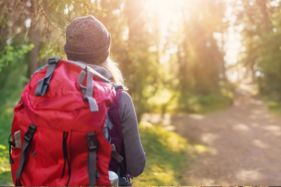
Whether you’re looking for your next big adventure or simply to unplug and recharge by spending time in the great outdoors, we’ve compiled a list of the best places to backpack across the province of Ontario.
And while you’re at it, why not bring your camping hammock with you? Hammocks go perfectly with long hikes and overnight backpacking in Ontario. Backpacking hammocks are compact and lightweight, so you won’t have to worry about a heavy, bulky item to carry with you.
If you need a break, you can easily set up your hammock for a comfortable hang while you rest your aching feet, taking in the spectacular views at the same time. And if you’re really pooped, you can take a nap in your hammock, or set up camp for the night on long trails.
Check out our favourite backpacking hammocks for sale before you head out on one of the best backpacking trails in Ontario.
Lake Superior Coastal Trail, Lake Superior Provincial Park
If you’re up for a challenging yet rewarding hike, this trail is for you. The linear Coast Trail spans a good portion of Lake Superior’s coastline. While hiking along rocks, boulders, cliffs, beaches, coves, and forest, you can enjoy the spectacular views and relatively few bugs - especially if you've got the right gear!
Length of trail: 65 km
Difficulty: Moderate/Advanced
Did you know? The breathtaking landscape, including the coast, canyons, and hills, inspired the Group of Seven artists.
Google maps link: https://goo.gl/maps/iMVH7AHpZFF2 (Main access point)
Website: http://www.lakesuperiorpark.ca/index.php/hiking-the-coastal-trail
The Cup and Saucer Trail, Manitoulin Island
The Cup and Saucer Trail offers hikers two route options to get to Manitoulin Island’s highest point. After climbing up the steep trail, you can try to catch your breath while enjoying breathtaking views from the island’s iconic cliffs.
Length of trail: 14 km
Difficulty: Moderate
Did you know? The Cup and Saucer Trail winds through mixed deciduous forest and Silurian deposits that are 400 million years old!
Google rating: 4.7/5 – 281 Google reviews
Google maps link: https://goo.gl/maps/H4ETgJ4jEWB2
Website: http://www.ontariotrails.on.ca/trails/view/cup-saucer-trail
La Cloche Silhouette Trail, Killarney Provincial Park
This rugged, looping trail begins and ends at George Lake Campground. Along the trail, you will pass through forests, creeks, and quartzite ridges of the La Cloche mountain range.
Length of trail: 100 km
Difficulty: Difficult
Did you know? A side trail leads to Silver Peak, Killarney’s highest point, and the Crack Trail, known as “The Crack,” which provides access to scenic lakes and trees that also inspired members of the Group of Seven.
Google maps link: https://goo.gl/maps/rwgdNUZaegm
Website: http://www.ontariotrails.on.ca/trails/view/la-cloche-silhouette-trail
Top of The Giant Trail, Sleeping Giant Provincial Park
This trail isn’t for the faint of heart. To reach this trail, hikers must first start at the southern Kabeyun Trail, then continue north on the Talus Lake Trail. After a steep climb, you can reach the top of the Sleeping Giant, and then trek for 2 kilometres to the “knees of the giant,” which is a lookout over Lake Superior.
Length of trail: 22 km (round trip)
Difficulty: Difficult
Did you know? The “knees of the giant” lookout is 228.6m (750 ft.) above Lake Superior and is one of the highest points in Ontario.
Google maps link: https://goo.gl/maps/KGT1pxYdT3u
Website: https://superiorhiking.com/top-of-the-giant/
The Bruce Trail, Southwestern Ontario
The long-distance Bruce Trail spans along the Niagara Escarpment, from the Niagara River to the tip of the scenic Bruce Peninsula. Along the way, you can enjoy vibrant blue water, waterfalls, caves, beaches, meadows, forests, and views from cliff tops.
Length of trail: 890 km
Difficulty: Moderate to Difficult
Did you know? The Bruce Trail is Canada’s oldest and longest hiking trail.
Google rating: 4.5/5 – 4 Google reviews
Google maps link: https://goo.gl/maps/Ax6jXywbNN42
Website: https://brucetrail.org/
The Voyageur Trail, Northern Ontario
This lengthy trail travels along the rugged shores of Lake Huron and Lake Superior, going from Sudbury through Sault Ste. Marie and all the way to Thunder Bay.
Length of trail: 600 km
Difficulty: Moderate to Difficult
Did you know? The Voyageur Trail coincides with much of the trade route of the Voyageurs, the early French fur traders who opened up the area.
Website: http://www.ontariotrails.on.ca/trails/view/voyageur-trail
Coastal Trail, Pukaskwa National Park
The Coastal Trail follows the rugged shoreline of Lake Superior, similar to the Voyageur Trail, but is located in Pukaskwa National Park. It is renowned for being a challenging trail with beautiful beaches, campsites, and views.
Length of trail: 60 km
Difficulty: Difficult
Did you know? This trail is so challenging that hikers need to attend an orientation first. And most hikers choose to take a boat 30 km up the coast to hike only half the trail.
Google maps link: https://goo.gl/maps/tCiW7vhdBsy
Nokomis Trail, Lake Superior Provincial Park
If you want a shorter trail with stunning vistas, this trail’s for you. Trek upwards for a stunning view of Lake Superior. You can enjoy the view of Old Woman Bay, and maybe even see Nokomis—the grandmother of an Ojibway demi-god—in the rock face of a cliff.
Length of trail: 5 km
Difficulty: Moderate
Did you know? The Old Woman River Valley marks an ecological boundary between the deciduous forest to the south and the Boreal forest to the north. So come fall, you can view the vibrant fall colours on one side, while the Boreal forest remains evergreen.
Google rating: 4.8/5 – 4 Google reviews
Google maps link: https://goo.gl/maps/E16ZhW4KMiy
Website: http://www.ontariotrails.on.ca/trails/view/nokomis-trail
Kabeyun Trail, Sleeping Giant Provincial Park
This scenic coastal trail goes along the Lake Superior shoreline, starting at the Thunder Bay Lookout. It even goes around the Sleeping Giant’s feet (the tip of the peninsula)! This trail also offers striking views from 244-metre-high cliffs.
Length of trail: 40 km
Difficulty: Strenuous
Did you know: This trail is popular for cyclists who want to cut down their hiking time.
Google maps link: https://goo.gl/maps/PDuq6bj42CG2
Website: http://www.ontariotrails.on.ca/trails/view/kabeyun-trail
The Ganaraska Trail, Southwestern Ontario
This long trail runs from Port Hope to the Bruce Trail near Collingwood and is sectioned into eight legs. The Devil’s Lake to Victoria Bridge portion of the trail is one of the most rugged and remote parts known for black bear sightings.
Length of trail: > 400 km (500 km including all the branches or legs)
Difficulty: Difficult
Did you know? Hikers who complete the Ganaraska Hiking Trail End-to-End Challenge will receive a badge and certificate of completion from the Ganaraska Hiking Trail Association.
Google rating: 5/5 – 4 Google reviews
Google maps link: https://goo.gl/maps/SUcXivoBA3M2
Website: https://ganaraska-hiking-trail.org/
The Casque Isles Hiking Trail, Northwestern Ontario
This section of the Voyageur Trail is divided into five parts along the bays of the Lake Superior shoreline. Along with rugged scenery, hikers can discover many cultural attractions, such as old trapper cabins, gold mines, and caves with pictographs painted by ancient First Nations peoples.
Length of trail: 53 km
Difficulty: Moderate
Did you know? The Casque Isles were named for their helmet-like appearance—casque is the French word for helmet.
Google rating: 4.5/5 – 14 Google reviews
Google maps link: https://goo.gl/maps/Dtw23dFJaBt
Website: http://www.voyageurtrail.ca/trailscasqueisles.html
The Cliff Top Trail, Bon Echo Provincial Park
This short trail has some steep climbs, so what it lacks in distance it makes up for in exertion. And as the name suggests, you can end up on the top of a cliff, enjoying the views of the water and landscape below.
Length of trail: 1.5 km
Difficulty: Beginner
Did you know? This trail is only accessible by water, so be prepared to paddle or ferry your way over to the trail. While you’re on the water, keep your eye out for Indigenous pictograph paintings on the rock.
Website: http://www.ontariotrails.on.ca/trails/view/clifftop-trail---bon-echo
With so many Ontario hiking trails to choose from, you can enjoy endless, tiresome, yet rewarding backpacking adventures throughout the year.
Whether you choose a short day hike or a week-long, backbreaking hiking marathon in the backcountry, don’t forget to give your back and your feet a rest by hanging in your handy backpacking hammock.
Have you hiked any of these trails? We'd love to hear from you!
Comment below and share your experience
Safety First!
When using a hammock*, safety is paramount. Please make sure to follow these important guidelines when purchasing, installing and using a hammock
*(includes Hammock, Hammock Chair, Hammock Stand and Hammock Accessories)


